Trail Description
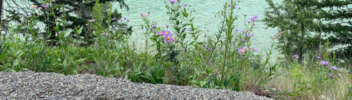
Approximately one kilometer long and featuring a packed, crushed gravel surface, the Bull Canyon Provincial Park Low Mobility Trail travels through forest, offering views of the glacial blue Chilcotin River and passes indigenous pit houses. There is a viewpoint near the river and benches and rest stops along the trail.
An accessible outhouse and plenty of parking are also available. The trail has a slight grade with one gentle hill. An information kiosk at the trailhead displays a map of the trail's route. Ongoing management of the site is provided by BC Parks.
Location
52°05′17″N 123°23′39″W
The trail is located six kilometres west of Alexis Creek on Highway 20 at the Bull Canyon Provincial Park.
Directions
From the intersection of Highway 97 and Highway 20, head west on Highway 20 for approximately one hundred and twenty-two kilometers. Turn left at the entrance to Bull Canyon Provincial Park. The trailhead is on the left, four hundred meters from the park entrance.
Contact Us
Central Cariboo - Williams Lake
Suite D, 180 North Third Avenue, Williams Lake, BC V2G 2A4
Phone: 250-392-3351
Fax: 250- 392-2812
Toll-Free: 1-800-665-1636
Website
Map this location
